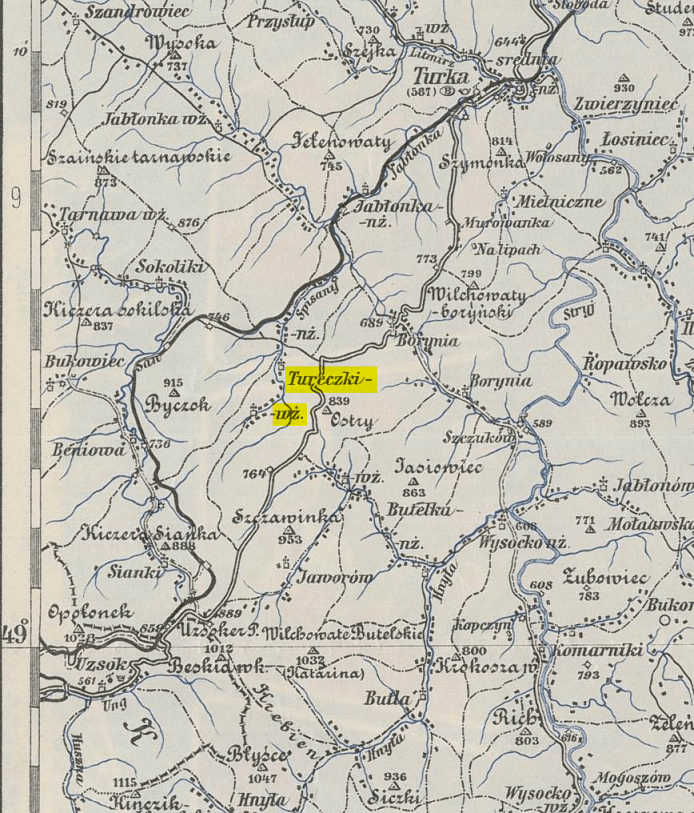
1910 Map of Tureczki-Wyzne
Turechki-Vyzhniy/Tureczki-Wyzne
Turechki-Vyzhniy (Ukrainian) is located in the Northern slopes of the Carpathian mountains about 3 miles away from the Polish/Ukrainian border. (Wyzne/Vyzhniy means 'higher' or 'upper'.) Known more as Tureczki-Wyzne (Polish) at the turn of the century, the village was in the Administration District of Turka in the Gmina of Borynia in the Austrian Province of Galicia. It was also known as Turow-Wyzne during the inter-war period (1919-1939). In the 1921 census, the population of Tureczki-Wyzne was given as 465 and population of Tureczki-Nizne was 614. The local Greek Catholic Parish Church is in nearby Turechki-Nyzhniy (Nizne/Nyzhniy means 'lower'). Today the village is known as Верхній Турів (Verchniy-Turiv).
It is in a deep valley in the shadows of Mount Buchok (3,000ft / 914m) on the west and Mount Ustreh (2,750ft / 839m) on the east. Located on the Skoloban river that flows north through Turechki-Nyzhniy. The village itself is approximately 1.25 miles (2km) long and lies about 0.6 mile (1km) west of the main Sambir to Uzhorod highway. The map dates from around the turn of the century.
Latitude: 49.0667° | 49° 4' 0" N
Longitude: 22.9167° | 22° 55' 0" E
Altitude: 2335ft | 711m
